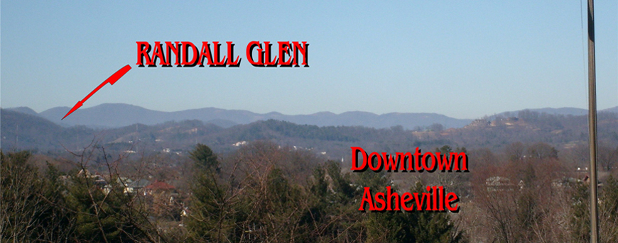
Follow our Randall Glen signs!
Google or GPS: Enter 96 Randall Cove Road, Leicester, NC 28748
If you are using GPS on your phone, be aware that you will lose service in the mountains.
Be sure you have gas before you come! There are no service stations in Big Sandy Mush.
From Asheville:
From Patton Avenue, go north on the New Leicester Highway (NC-63) 11.1 miles, passing through the community of Leicester. Turn left onto North Turkey Creek ( not South Turkey Creek); at the corner you’ll see a small Trading Post. Go 2.1 miles and bear right onto Early’s Mountain Road. Go over Early’s Mountain and stay on the same road as the name changes to Big Sandy Mush Road. Continue through the valley another 3.8 miles, with the name changing again to Bald Creek Road, until the pavement ends. Just before this you’ll see a yellow road sign with a cow symbol. Where the pavement turns to gravel, turn right on Surrett Cove Road. Go .6 mile to the cul de sac and take Randall Cove Road, the small gravel road on the left. When you come to a “Y” after .2 mile, keep right and go .3 mile further to another “Y” and turn left; this is our drive. Go up the hill to the red Barnhouse. (About 35 minutes)
From I-40 (the Gentle Route):
Take Newfound Road/Exit 33; follow the signs for Leicester (Newfound Road). Continue 12 miles on Newfound Road. At the “T”, turn left onto the New Leicester Highway (NC-63). Turn left onto North Turkey Creek ( not South Turkey Creek); at the corner you’ll see a small Trading Post. Go 2.1 miles and bear right onto Early’s Mountain Road. Go over Early’s Mountain and stay on the same road as the name changes to Big Sandy Mush Road. Continue through the valley another 3.8 miles, with the name changing again to Bald Creek Road, until the pavement ends. Just before this you’ll see a yellow road sign with a cow symbol. Where the pavement turns to gravel, turn right on Surrett Cove Road. Go .6 mile to the cul de sac and take Randall Cove Road, the small gravel road on the left. When you come to a “Y” after .2 mile, keep right and go .3 mile further to another “Y” and turn left; this is our drive. Go up the hill to the red Barnhouse. (About 45 minutes)
From I-40 (the Mountain Route):
From I-40 West, take Newfound Road/Exit 33 and go almost straight across Newfound Road onto Freedom Road, which runs immediately parallel to I-40. From I-40 East, take Newfound Road/Exit 33. Turn left at the bottom of the exit (a sign points toward Leicester), cross over the interstate, then turn left onto Freedom Road, immediately next to I-40. On Freedom Road go .7 mile to the “T” and turn right onto Beaverdam Road. Continue on this same road for 8.2 miles over Beaverdam Gap and down into Big Sandy Mush; the name will change to Willow Creek Road. At the “T”, turn left onto Bald Creek Road. Continue 1.5 miles through the valley until the pavement ends. Just before this you’ll see a yellow road sign with a cow symbol. Where the pavement turns to gravel, turn right on Surrett Cove Road. Go .6 mile to the cul de sac and take Randall Cove Road, the small gravel road on the left. When you come to a “Y” after .2 mile, keep right and go .3 mile further to another “Y” and turn left; this is our drive. Go up the hill to the red Barnhouse. (About 30 minutes)
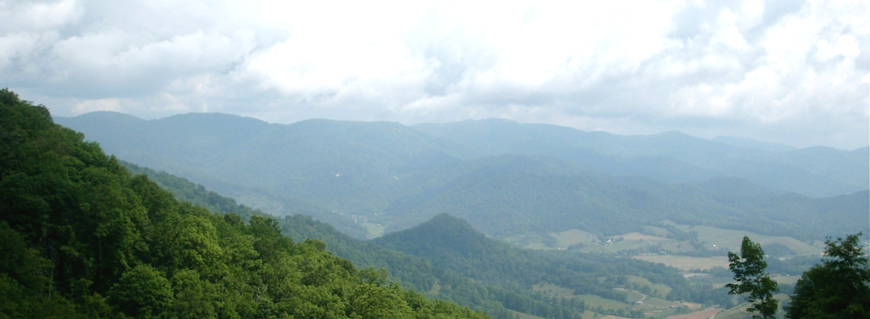
This route is quite beautiful, with an unparalleled view at the top but it is challenging, with steep, winding roads up and over Beaverdam Gap. This route is best for confident drivers who are accustomed to mountain driving. Do not go this way in winter weather. The road can be impassable due to snow and ice, even when there is no ice at lower elevations.
From Asheville or I-40 (the No-Mountain Route):
On the New Leicester Highway (NC-63), go PAST North Turkey Creek and continue 4.1 miles. You will pass a rural gas station with a Triangle Gas sign, then cross a small bridge with an “Entering Madison County” sign. Almost immediately after the bridge, turn left onto Sandy Mush Creek Road. Go 2.6 miles to the “T” and turn right onto Big Sandy Mush Road. Go 3.9 miles, with the name changing to Bald Creek Road. You’ll see a yellow road sign with a cow symbol. Take the next right turn after the cow sign onto Surrett Cove Road. Go .6 mile to the end of the pavement and take Randall Cove Road, the small gravel road on the left. There is a Randall Glen sign, with an arrow, fixed to the roadsign. There are two more Randall Glen signs; following the arrows, when you come to a “Y” after .2 mile, keep right and go .3 mile further to another “Y” and turn left; this is our drive. Go up the hill to the red Barnhouse and park in the barnyard beyond the house. (About 20 minutes longer than the other routes, but fairly level)