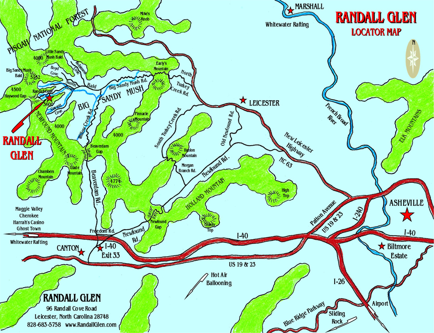
Randall Glen is located in the community of Big Sandy Mush, about 15 miles northwest of Asheville, North Carolina. We’re in the same county as Asheville; our post office is the town of Leicester. We’re surrounded by the highest mountains close to Asheville, and our glen is part of the Pisgah National Forest.
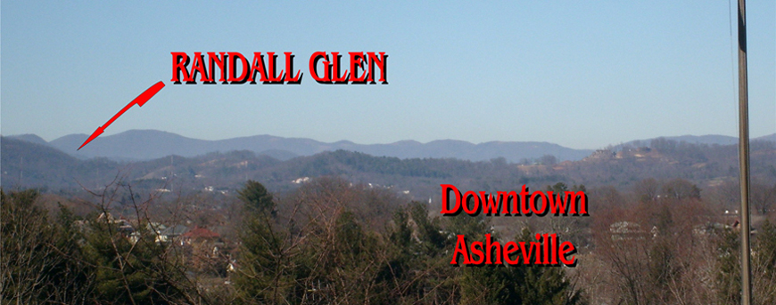
We’re 30 to 45 minutes from downtown Asheville, the Biltmore Estate, the Farmer’s Market, the Arboretum, the Nature Center, Maggie Valley, and the Blue Ridge Parkway. We’re an hour or less from Cherokee, whitewater rafting, snow skiing, hot air ballooning, the Great Smoky Mountain Railway, and most other area destinations.
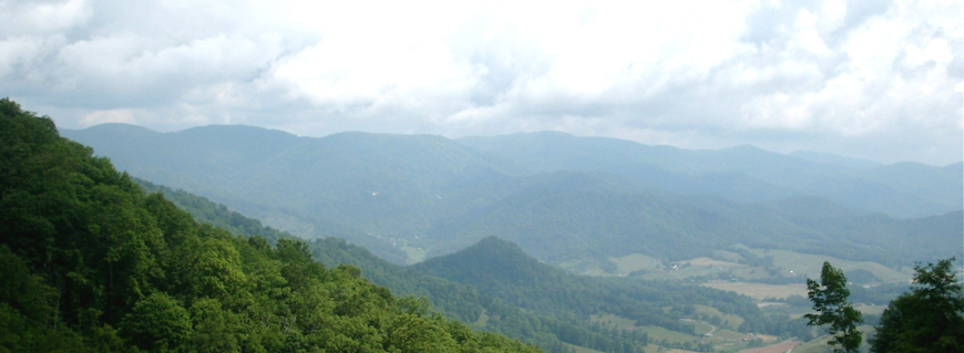
Randall Glen isn’t hard to find, but you do go “over the river and through the wood” to reach us. In fact, a Southern Highlander once told us, “You’re so far back, you’ve got hootie owls for roosters!”. Once you’ve been here we think you’ll agree our secluded location is our greatest asset. We have the best of all worlds-we’re only minutes from Asheville and enjoy the benefits of superb City and County services, but we are at the very end of our valley. There are no highways, no housing developments, no “commercial strip”. There is absolutely no casual traffic passing Randall Glen. The only sounds in the night are those of nature. Sometimes the only indication that we’re in the modern world is an airplane high overhead. We are truly in the heart of the Great Smoky Mountains.
Directions:
Follow our Randall Glen signs!
Mapquest or GPS: Enter 96 Randall Cove Road, Leicester, NC
From Asheville: From Patton Avenue, go north on the New Leicester Highway (NC-63) 11.1 miles, passing through the community of Leicester. Turn left onto North Turkey Creek ( not South Turkey Creek); at the corner you’ll see a small Trading Post. Go 2.1 miles and bear right onto Early’s Mountain Road. Go over Early’s Mountain and stay on the same road as the name changes to Big Sandy Mush Road. Continue through the valley another 3.8 miles, with the name changing again to Bald Creek Road, until the pavement ends. Just before this you’ll see a yellow road sign with a cow symbol. Where the pavement turns to gravel, turn right on Surrett Cove Road. Go .6 mile to the cul de sac and take Randall Cove Road, the small gravel road on the left. When you come to a “Y” after .2 mile, keep right and go .3 mile further to another “Y” and turn left; this is our drive. Go up the hill to the red Barnhouse. (About 35 minutes)
From I-40 (the Gentle Route): Take Newfound Road/Exit 33; follow the signs for Leicester (Newfound Road). Continue 12 miles on Newfound Road. At the “T”, turn left onto the New Leicester Highway (NC-63). Turn left onto North Turkey Creek ( not South Turkey Creek); at the corner you’ll see a small Trading Post. Go 2.1 miles and bear right onto Early’s Mountain Road. Go over Early’s Mountain and stay on the same road as the name changes to Big Sandy Mush Road. Continue through the valley another 3.8 miles, with the name changing again to Bald Creek Road, until the pavement ends. Just before this you’ll see a yellow road sign with a cow symbol. Where the pavement turns to gravel, turn right on Surrett Cove Road. Go .6 mile to the cul de sac and take Randall Cove Road, the small gravel road on the left. When you come to a “Y” after .2 mile, keep right and go .3 mile further to another “Y” and turn left; this is our drive. Go up the hill to the red Barnhouse. (About 45 minutes)
From I-40 (the Mountain Route): From I-40 West, take Newfound Road/Exit 33 and go almost straight across Newfound Road onto Freedom Road, which runs immediately parallel to I-40. From I-40 East, take Newfound Road/Exit 33. Turn left at the bottom of the exit (a sign points toward Leicester), cross over the interstate, then turn left onto Freedom Road, immediately next to I-40. On Freedom Road go .7 mile to the “T” and turn right onto Beaverdam Road. Continue on this same road for 8.2 miles over Beaverdam Gap and down into Big Sandy Mush; the name will change to Willow Creek Road. At the “T”, turn left onto Bald Creek Road. Continue 1.5 miles through the valley until the pavement ends. Just before this you’ll see a yellow road sign with a cow symbol. Where the pavement turns to gravel, turn right on Surrett Cove Road. Go .6 mile to the cul de sac and take Randall Cove Road, the small gravel road on the left. When you come to a “Y” after .2 mile, keep right and go .3 mile further to another “Y” and turn left; this is our drive. Go up the hill to the red Barnhouse. (About 30 minutes)
This route is quite beautiful, with an unparalleled view at the top but it is challenging, with steep, winding roads up and over Beaverdam Gap. Coming down from the gap, 2.2 miles are unpaved. This route is best for confident drivers who are accustomed to mountain driving. Do not go this way in winter. The road can be impassable due to snow and ice.
ROCKY CREEK CAMPGROUND
Mapquest or GPS: Enter 77 Boyd Cove Road, Leicester, NC 28748
- Be sure you have gas before you come!
- There are no service stations in Big Sandy Mush.
From I-40 (the Mountain Route): From I-40 West, take Newfound Road/Exit 33 and go straight across Newfound Road onto Freedom Road, which runs immediately parallel to I-40. From I-40 East, take Newfound Road/Exit 33. Turn left at the bottom of the exit (a sign points toward Leicester), cross over the interstate, then turn left onto Freedom Road, immediately next to I-40. On Freedom Road go .7 mile to the “T” and turn right onto Beaverdam Road. Continue on this same road for 8.2 miles over Beaverdam Gap and down into Big Sandy Mush; the name will change to Willow Creek Road. At the “T”, turn left onto Bald Creek Road. Go 1.3 miles and turn right onto Boyd Cove Road. Go .3 mile and turn left into Rocky Creek Campground. (About 25 minutes from I-40)
Do not take this route with any vehicle in winter.